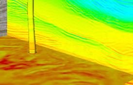
🗺️ Geographical Information System (GIS) in the Oil and Gas Industry
📘 Course Description: This hands-on course is designed to introduce oil and gas professionals to the practical use of Geographic Information Systems (GIS) for exploration, development, and operations. Participants will gain skills in spatial data acquisition, integration, analysis, and visualization …
Overview
📘 Course Description:
This hands-on course is designed to introduce oil and gas professionals to the practical use of Geographic Information Systems (GIS) for exploration, development, and operations. Participants will gain skills in spatial data acquisition, integration, analysis, and visualization to support decision-making in upstream and midstream projects.
The course emphasizes real-world petroleum applications using ArcGIS (or QGIS as an alternative), and includes exercises in mapping wells, surface infrastructure, pipeline routing, reservoir monitoring, and environmental compliance.
🎯 Who Should Attend:
-
Geologists & Geophysicists
-
Reservoir & Petroleum Engineers
-
GIS Analysts
-
Exploration Managers
-
Environmental Scientists
-
Land and Regulatory Professionals
🧾 Training Format:
-
Duration: 5 Days
-
Format: Classroom or Live Online
-
Tools: ArcGIS Pro / ArcMap / QGIS (based on availability)
-
Method: Lectures, Demonstrations, and Hands-on Exercises
-
Materials: Digital course manual, GIS datasets, project templates
🗓️ 5-Day Daily Agenda with Time Breakdown
Day 1: Introduction to GIS and Spatial Thinking in Oil & Gas
Time | Topic |
---|---|
09:00 – 09:30 | Course Overview & Objectives |
09:30 – 10:30 | Fundamentals of GIS: Concepts & Components |
10:30 – 10:45 | ☕ Coffee Break |
10:45 – 12:15 | GIS Data Models: Vector, Raster, Coordinate Systems |
12:15 – 13:15 | 🍽️ Lunch Break |
13:15 – 14:45 | Introduction to ArcGIS/QGIS Interface |
14:45 – 15:00 | ☕ Coffee Break |
15:00 – 16:30 | Importing & Visualizing Oilfield Data (Wells, Seismic, etc.) |
Day 2: Spatial Data Management & Integration
Time | Topic |
---|---|
09:00 – 10:30 | Data Sources in Oil & Gas: Surveys, Maps, Satellite, DEM |
10:30 – 10:45 | ☕ Coffee Break |
10:45 – 12:15 | Georeferencing & Digitizing Surface and Subsurface Features |
12:15 – 13:15 | 🍽️ Lunch Break |
13:15 – 14:45 | Attribute Tables and Data Queries |
14:45 – 15:00 | ☕ Coffee Break |
15:00 – 16:30 | Creating & Editing Well and Pipeline Layers |
Day 3: Mapping and Spatial Analysis
Time | Topic |
---|---|
09:00 – 10:30 | Thematic Mapping for Exploration & Production |
10:30 – 10:45 | ☕ Coffee Break |
10:45 – 12:15 | Contour Mapping, Elevation Models & Surface Interpolation |
12:15 – 13:15 | 🍽️ Lunch Break |
13:15 – 14:45 | Spatial Analysis Tools (Buffers, Clipping, Joins) |
14:45 – 15:00 | ☕ Coffee Break |
15:00 – 16:30 | Exercise: Reservoir Extent Mapping & Infrastructure Planning |
Day 4: Advanced GIS Applications in Oil & Gas
Time | Topic |
---|---|
09:00 – 10:30 | GIS for Environmental and Regulatory Compliance |
10:30 – 10:45 | ☕ Coffee Break |
10:45 – 12:15 | GIS in Well Planning, Surface Facility Design, & Land Access |
12:15 – 13:15 | 🍽️ Lunch Break |
13:15 – 14:45 | Pipeline Route Optimization using GIS |
14:45 – 15:00 | ☕ Coffee Break |
15:00 – 16:30 | Time-Series & Temporal GIS (e.g., production monitoring) |
Day 5: Project Workflow and Integration
Time | Topic |
---|---|
09:00 – 10:30 | Integration of GIS with Subsurface Data (Seismic, Logs) |
10:30 – 10:45 | ☕ Coffee Break |
10:45 – 12:15 | Web GIS, Dashboards & Mobile GIS Applications |
12:15 – 13:15 | 🍽️ Lunch Break |
13:15 – 14:45 | Final Project: Build a GIS Project for a Field Development Plan |
14:45 – 15:00 | ☕ Coffee Break |
15:00 – 16:30 | Presentations, Q&A, Feedback, and Certificate Distribution |
Target audiences
- Reservoir Engineers, Geologists
You May Like
🛢️ Geomechanics and Rock Mechanics for Drilling Optimization
📘 Course Description: This course provides an in-depth understanding of geomechanics and rock mechanics principles as they apply to drilling optimization. It focuses on predicting and mitigating wellbore instability, mud losses, stuck pipe incidents, kicks, and well control issues. Participants …
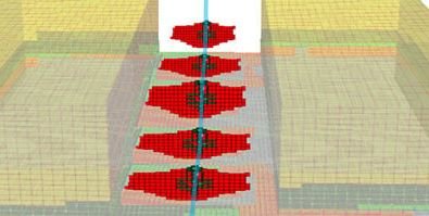
🛢️ Introduction to Reservoir Geomechanics and Its Application
📘 Course Description: This course introduces the fundamentals of reservoir geomechanics and explores its applications throughout the lifecycle of hydrocarbon reservoirs—from drilling and production to enhanced recovery and field abandonment. Participants will gain a solid understanding of the stress-strain behavior …
🛢️ Advanced Exploration and Drilling Geomechanics
📘 Course Description: This advanced course is designed for professionals involved in exploration and drilling who require in-depth understanding of applied geomechanics. It focuses on advanced geomechanical modeling, prediction, and mitigation of wellbore instability, drilling-induced fractures, fault reactivation, and subsurface …
🪨 Introduction to Geomechanics
📘 Course Description: This foundational course introduces geoscientists, engineers, and technical professionals to the principles and applications of geomechanics in the oil & gas, mining, civil engineering, and environmental sectors. Participants will learn how rock and soil mechanical behavior affects …
🤖 Integrating AI in Workplace Safety Practices
📘 Course Description: This forward-thinking course explores how Artificial Intelligence (AI) is revolutionizing workplace safety. Participants will gain hands-on understanding of AI tools and how they can predict hazards, prevent incidents, enhance inspections, and improve emergency response. From machine learning …